Benchmark jurisdictions against each other
- Use geospatial data to easily identify deforestation risk, water risk, climate risk and carbon sequestration opportunities
- Optimize new certification processes by benchmarking prospective areas against each other
Check farms for compliance
- Prepare for EU Deforestation Regulation
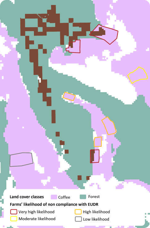
- Pinpoint farms with risk of being linked to deforestation
- Ease the audit process by recommending farms to be audited
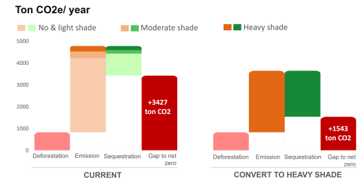
Find opportunity areas for carbon sequestration
“We used to estimate deforestation risk and shade tree presence through survey and local experts. Now we can use the more accurate and high-resolution Terra-i+ deforestation and shade tree data for this purpose”
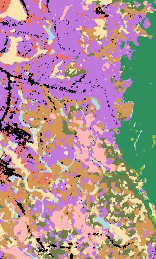
Our datasets
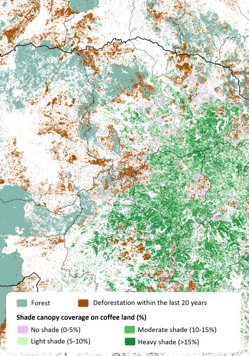
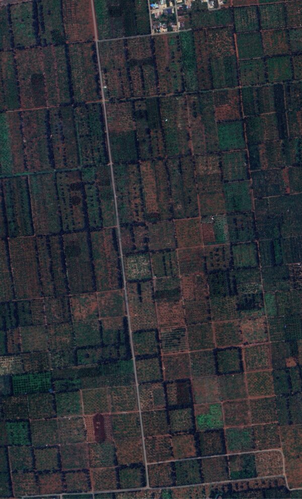
By analyzing Sentinel-1A/B imagery, our algorithm detects deforestation events with 10mx10m resolution. Deforestation events are updated every 12 days, enabling up-to-date and precise assessment of deforestation risk
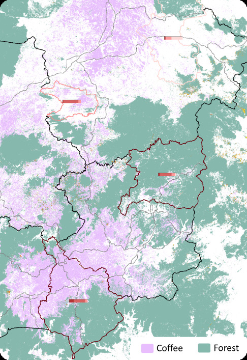
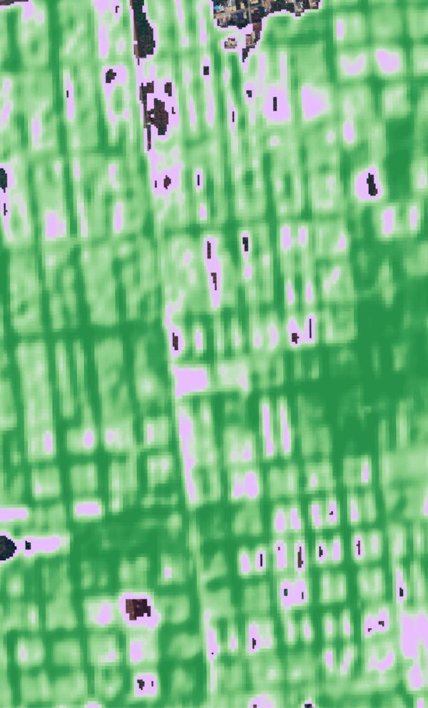
By applying a custom artificial intelligence to Sentinel 1&2 imagery, we created the land cover map with high accuracy for coffee, agroforestry, tree crops and forests. This high resolution land cover dataset enables the monitoring of crop-specific deforestation risk down to farm level.
By analyzing 19 crop suitability bioclimatic variables and averaging 19 climate scenarios, we created the climate suitability map for Robusta coffee until 2030, enabling an outlook into future suitability of current coffee areas.
By applying a custom artificial intelligence to Sentinel 1&2 imagery, we developed an innovative methodology to map shade trees, coffee and visible soil coverage. This high resolution shade cover dataset enables the tracking of annual above-ground carbon stock down to farm level.
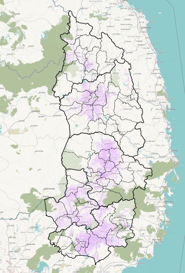
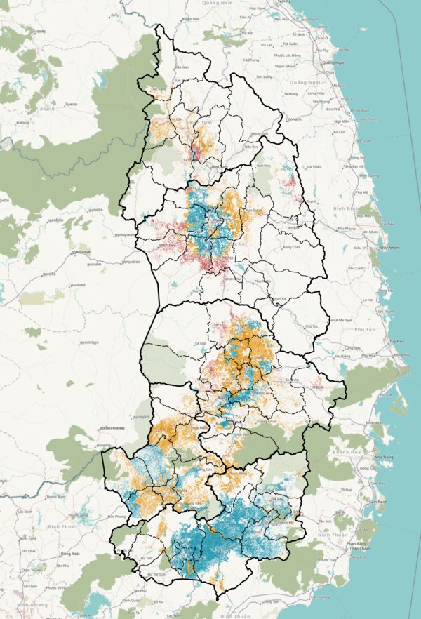
Where we are working
 Vietnam
Future expansion to major coffee and cocoa regions:
Guatemala
Brazil
Cameroon
Colombia
Ethiopia
Ghana
Ivory Coast
Kenya
Honduras
India
Indonesia
Uganda
Mexico
Nigeria
Peru